| Guest Writer | |
 Evan Thayer |
// OpenSnow Forecaster For Utah |
After smashing all Utah snowfall records during the 2022-23 ski season, we entered the 2023-24 ski season eagerly anticipating the encore Mother Nature had in store for us. The 903” of snow that fell at Alta Ski Area in 2022-23 was an all-time record for a Utah ski area. Could it be possible for us to see yet another blockbuster winter?
While we didn’t threaten records again, we did see a season that gradually gained momentum as El Niño flexed its muscles after the calendar turned to 2024. Significantly above-normal snowfall was observed thanks to strong storm cycles in January, February, and March. Given that these are three of the four snowiest months in Utah, it should come as little surprise that this led to a solidly above-normal overall snowpack statewide.
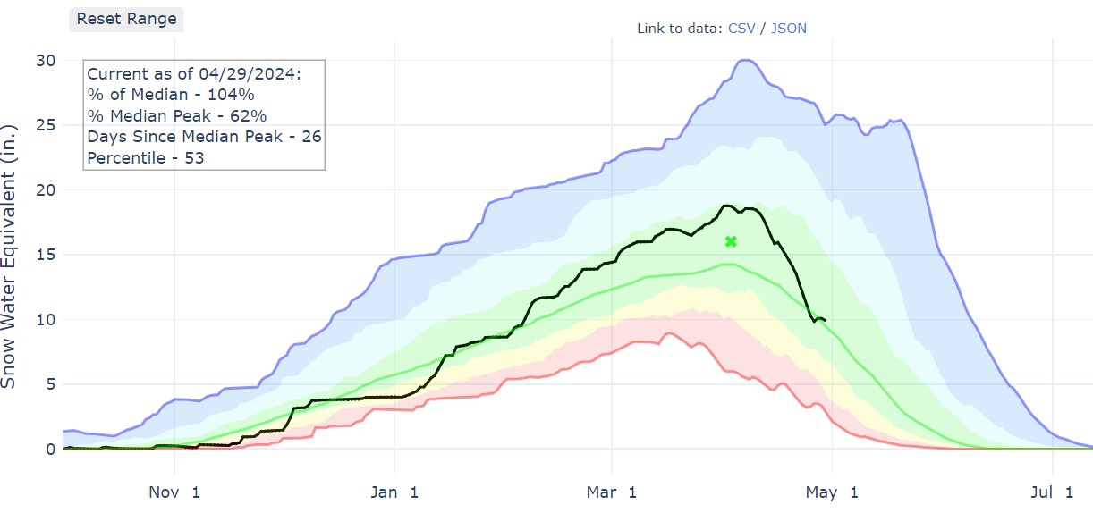
Last year (spring 2023), Utah broke its record for average snowpack at its 114 Snotel sites with a mean of 30” of snow-water-equivalent. This was almost double the typical peak snowpack in the spring. This year, we finished at nearly 19” of mean snow-water equivalent. This was 118% of the median peak snowpack.
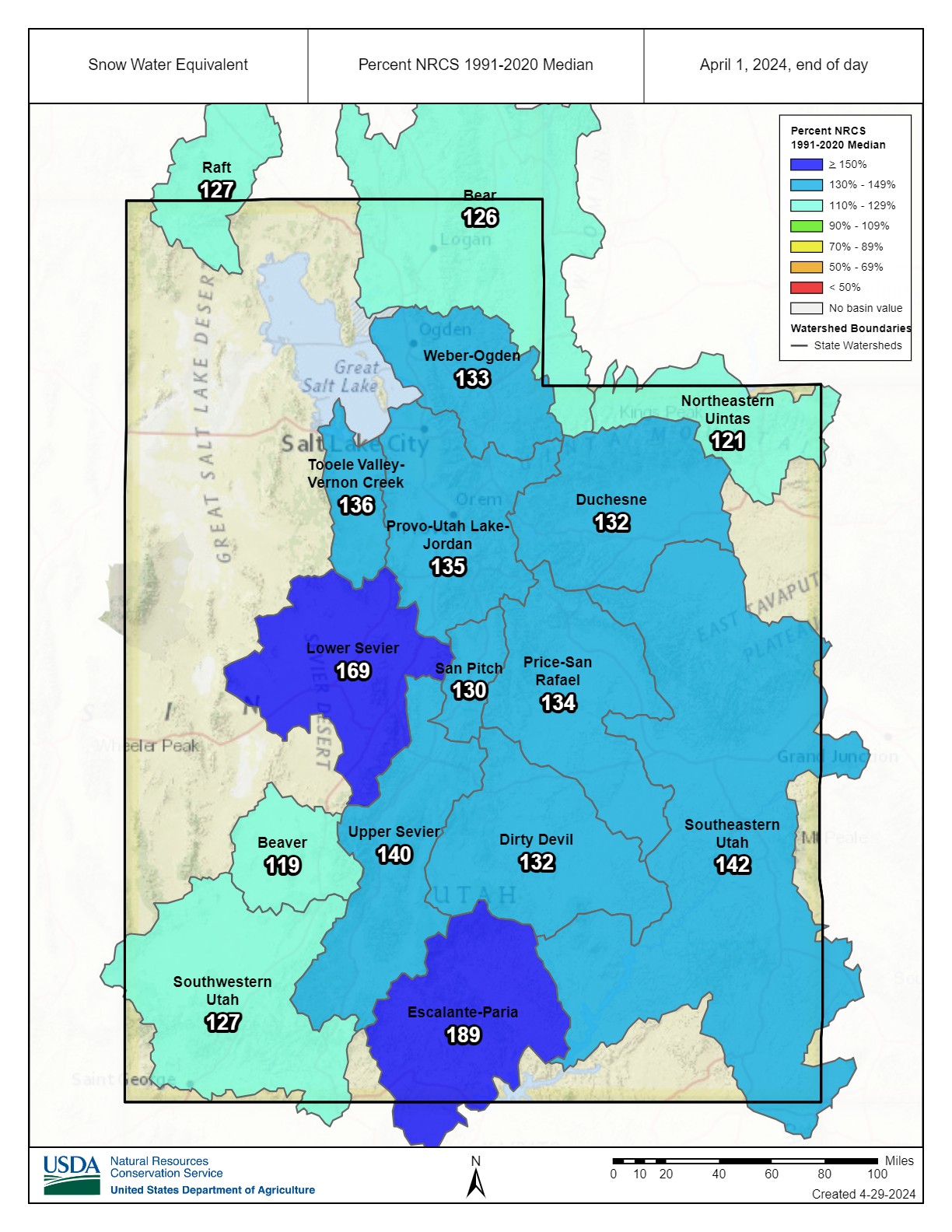
In fact, every watershed basin in Utah was well above normal snowpack as of April 1 when the statewide snowpack peaked.

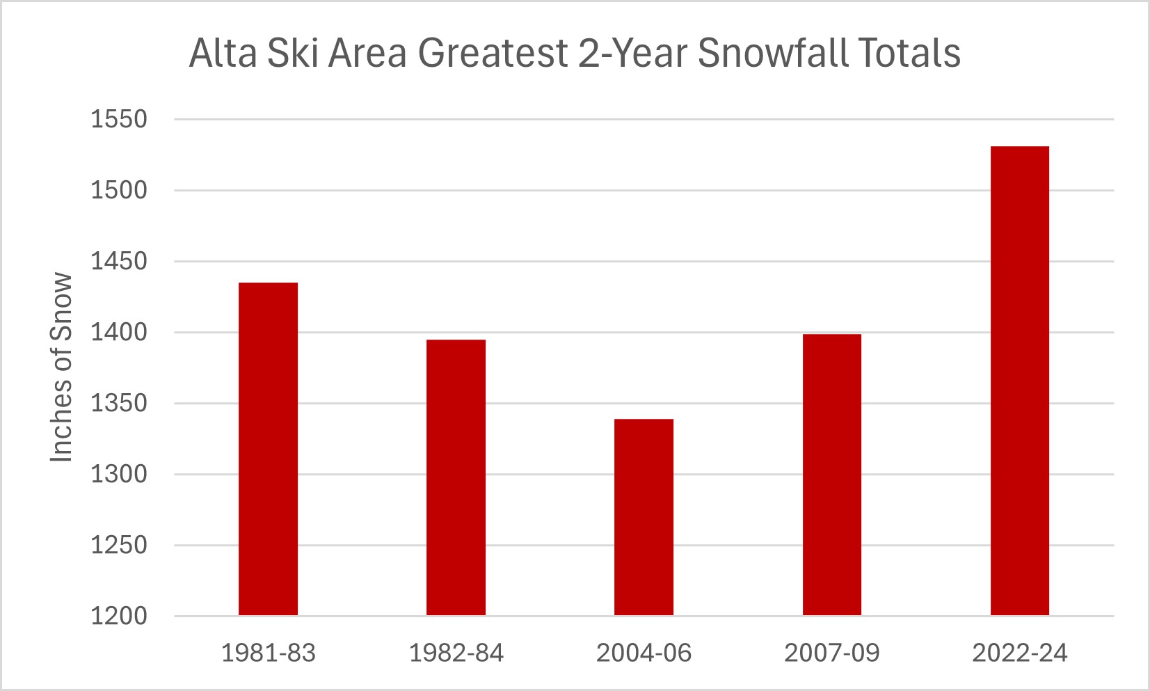
When we combine the 903” from the 2022-23 season with the 628” that fell at Alta Ski Area this winter, we get a 2-year total of 1531 inches. For many prominent ski destinations across the country, that’s more than 5 full seasons worth of snow
This is also the highest 2-year total snowfall in Utah’s history. Even the three famously snowy seasons from 1981-84 in Utah did not have that much snow over two consecutive seasons.

Aside from the obvious benefits to skiers and snowboarders, this surplus of snow will also continue to help raise the levels of the Great Salt Lake, Lake Powell, and other reservoirs and lakes throughout the state.
As for what comes next winter, it’s far too early to say with any confidence. We will have an opportunity to match the three consecutive snowy winters of the early 1980s. Meteorologically, early indications show a high likelihood of bouncing back into La Niña conditions over the Pacific Ocean. While we don’t have a strong correlation to La Niña or El Niño in Utah, La Niña does theoretically elevate the chances for a colder-than-average winter. With any luck, it will also be snowier-than-average as well.


